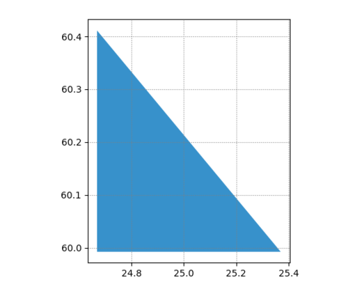
使用 Matplotlib 绘制坐标会扭曲底图
我正在尝试使用 Geopandas 和 Matplotlib 在地图上显示商店的空间分布。
问题: 当我绘制图钉时,底图会变形。

这是绘制引脚之前和之后的示例

问题: 这种失真的来源是什么?我该如何预防?
import pandas as pd
import geopandas as gpd
import matplotlib.pyplot as plt
from shapely.geometry import Polygon
# Creating the simplified polygon
latitude = [60.41125, 59.99236, 59.99236]
longitude = [24.66917, 24.66917, 25.36972]
geometry = Polygon(zip(longitude, latitude))
polygon = gpd.GeoDataFrame(index=[0], crs = 'epsg:4326', geometry=[geometry])
# ploting the basemap
ax = polygon.plot(color="#3791CB")
# Dict of sample coordinates
coordinates = {"latitude": ["60.193141", "60.292777", "60.175053", "60.163187", "60.245272", "60.154392", "60.182906"],
"longitude": ["24.934214", "24.969730", "24.831068", "24.739044", "24.860983", "24.884773", "24.959175"]}
# Creating a dataframe from coordinates
df = pd.DataFrame(coordinates)
# Creating the GeoDataFrame
shops = gpd.GeoDataFrame(coordinates, geometry=gpd.points_from_xy(df.longitude, df.latitude))
# Plotting office coordinates
shops.plot(ax=ax, color="red", markersize = 20, zorder=2)
# adding grid
plt.grid(linestyle=":", color='grey')
plt.show()
谢谢你!
 开满天机
开满天机1回答
-

哆啦的时光机
你的地图和别针有不同的参考系统..当您创建第一个 GeoDataFrame 时,您指定其坐标参考系统 (crs = 'epsg:4326')。当您为商店坐标创建地理数据框时,您不需要。这就是失真的来源……这应该修复它:shops = gpd.GeoDataFrame( coordinates, geometry = gpd.points_from_xy( df.longitude, df.latitude), crs = "EPSG:4326" ) )
 随时随地看视频慕课网APP
相关分类

 Python